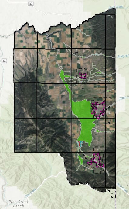
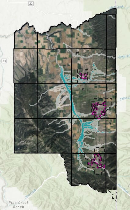
For some reason, of all the “layers” encompassing lands throughout Teton Valley (or anywhere else), floodplain has always been the most difficult for me to understand. Merriam-Webster defines floodplain as “level land that may be submerged by floodwaters, or a plain built up by stream deposition.” To me, floodplain isn’t necessarily always flat, but it isn’t the definition that I struggle with. It more has to do with what it means for those that have floodplains indicated on their property.
Before I go any further here, and with my preface out of the way, I STILL struggle with floodplain. With that—and all articles I have written over the years—take this with a grain of salt. These are my interpretations about complex issues, and I have no authority on these matters. Always do your own research through proper authoritative agencies.
Tayson’s definition of floodplain, and the purpose of having this information:
I don’t think anybody’s really struggling with the definition here, but to expand: Floodplain, as I understand it, is determined through elevation (obviously the low-lying areas are going to accumulate water), hydrology (how water moves), and soil types. For example, in a past article I talked about attending a FEMA open house at the Teton County Courthouse, which detailed how this data is collected and how the County is working with FEMA to update its flood maps. As of this writing, the appeal period for those wishing to contest the proposed maps is closing, paving the way for final approval of the new, more accurate flood zones and associated maps.
The purpose of having this data:
To me, the greatest benefit of having this information is to mitigate risk. In a real-life scenario, I don’t think that Merriam-Webster’s definition works to describe potential areas of risk. Since water moves in precarious ways, we can hope to rely on science and data to give us that clearer picture of areas of risk. This can then be used for landowners to plan new projects or mitigate risk with existing structures. It’s also used by insurance companies—particularly those participating in the National Flood Insurance Program—to assess flood risk and determine insurance requirements. As I understand it, the NFIP is a federal program managed by FEMA that provides flood insurance to property owners, renters, and businesses, and it relies heavily on FEMA’s floodplain maps to assess risk and set insurance rates.
How the data is obtained and displayed:
Again, no expert here, but I do know that the latest information available was provided through LiDAR flyovers to gather contours and terrain, as well as hydrologic and soil studies to model how water moves and flows. Because of the level of technology, these maps can display not only areas of concern but also different levels of risk in certain areas. Historically, my understanding was that the primary defined areas of risk included 100-year and 500-year flood risk areas. I also understand that new efforts are being made to display this risk through percentages as opposed to yearly events, so as not to confuse the intended definition of that risk.
As an example, a property in a 500-year flood risk area does not necessarily mean it will only flood once every 500 years. Describing that same risk as a 0.2% annual chance of flooding conveys the same statistical probability, but in a way that more clearly communicates the level of risk. Similarly, a 100-year flood event area might also be described as having a 1% annual chance of flooding. Because of the advanced technology used to gather this new data, additional flood risk areas can also be defined—but it’s important to remember that these are estimates based on modeling. Obviously, anything can happen.
Who creates the maps?
The maps themselves are generally created through FEMA (Federal Emergency Management Agency) in cooperation with the National Flood Insurance Program (NFIP) and local jurisdictions. FEMA contracts with engineering firms and works with local governments to ensure maps reflect both scientific modeling and local conditions. These are the same maps used for regulating development in flood-prone areas and determining flood insurance requirements.
Can the information be challenged?
As advanced as this data might be, it is broadly used across great areas of landscape. As a result, property owners or developers may have the opportunity to challenge this data through site-specific engineering to determine the exact elevation of a structure relative to the projected floodwaters. This is typically done through an elevation study, which can then be used to produce an Elevation Certificate. While this certificate is often required for determining compliance with building standards or securing flood insurance, it can also be submitted to FEMA to support a request to remove a structure from a mapped high-risk zone.
In some cases, more formal map changes are needed. A Letter of Map Amendment (LOMA) can be requested when a property owner believes their structure or lot was incorrectly included in a flood zone. These are often supported by Elevation Certificates and typically apply to individual lots or structures. For larger-scale changes—such as those affecting an entire development or subdivision—a Letter of Map Revision (LOMR) may be appropriate. These tools can be essential for developers and landowners when building or remodeling near designated floodplains.
What is the County’s role?
In the event that there is development in a floodplain, the County’s policy (as I interpreted during a meeting with the County on the subject) was for structures to be a minimum of one foot above freeboard.
In that meeting, they referred to something called “freeboard,” which, as it turns out, is a nautical term. In boating, freeboard is the distance between the waterline and the edge of the boat—basically the buffer that keeps water from spilling in. In the floodplain world, it’s a similar idea. Freeboard refers to the extra height that structures need to be built above the projected flood level. It gives a bit of wiggle room for things like model inaccuracies or bigger-than-expected storms. In Teton County, that buffer is currently set at one foot above the base flood elevation for any development in a flood zone, though which zone this applies to should be clarified prior to any construction.
Additionally, the representative in the meeting stated that the County does maintain some generic latitude, which might include looking at developable areas on a building site that may not be in the floodplain. There are also considerations when it comes to vegetation removal in instances of development in or around a floodplain, understanding that removing vegetation can also impact these waterways. Because I have not been able to point to any specific area of the code to identify the County’s requirements in addition to those set forth or recommended by FEMA, it is important to remember to consult with industry professionals and engineers, and to work directly with the planning and zoning and/or building departments to understand what’s allowed, and what’s required.


